Sunday 4 May 1997
The first day we start with the climb outside Playa del Ingles. It
is very hot and the climate is very dry. There is almost no vegetation
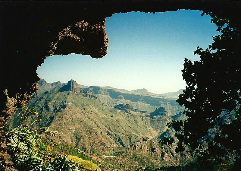
and the landscape is bare. We have some great views on the Barranco's,
deep red coloured canyons.
At Fataga we stop for a drink and here we see the finish of a cycling
race.
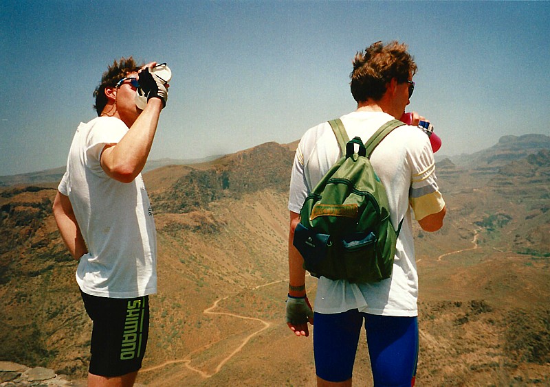
After San Bartolome the climb becomes harder and the hot temperature
is killing our energy. In La Plata we decide to descend and to take a short
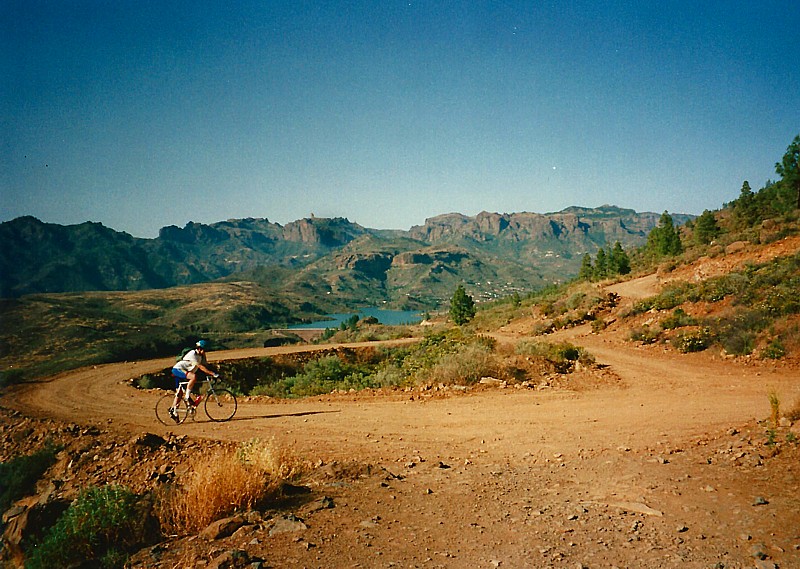
cut. On the map there is a tiny road to Maspalomas. The road to the lake
Embalse de Chira is perfectly paved. Just after the lake the good road
surface is vanished and only a dirt road is left. We wish we have a mountain
bike and hope that the road will change, but it doesn't. The road is 30
km long and it becomes dark very quickly. After several punctures we are
don't have any patches left and so we have to walk for about 10 km. Finally
we end at the back of a Pick-up truck and arrive at midnight in Playa del
Ingles.
Monday 5 May 1997
The second day we cycle along the coastal road to Mogan. There is a
lot of traffic on this road and frequently it goes up and down hill. In
Puerto de Mogan there is a light incline to Mogan, a nice village. After
Mogan the road rises steep in several hairpins through a forest. After
10 Km the surface of the road changes from perfectly paved to a dirt road.
We cycle together for about 1 km, but the road becomes even worse. Johan
and Martin decide to turn and I still follow the rough road. At a crossing
I choose not to go to the Embalse de Cueva de las Ninas and Ayacata, because
it becomes too late and the road is still very rough. I descend through
the Barranco de Arguineguin. I pass the Embalse de Soria, a small lake
and descend to El Barranquilo Andres and Cercado. In Arguineguin I follow
the same road as we did in the morning to the apartment.
Tuesday 6 May 1997
The third day we still want to reach the highest point of Gran Canaria,
the Pico de las Nieves (1980 meter). This time we try it from the south-east
approach. The road up to the north from Playa del Ingles is very annoying.
There is a lot of traffic on this four lanes road and wind can make it
even worse. This is the only road into the direction of Las Palmas. At
the airport the GC 812 is even following the highway.
In El doctoral we start to climb to Santa Lucia. The landscape is bare
and we climb for quiet a long time. Again we pass San Bartolome and
now we have more time and energy to push forward. In Ayacata the road becomes
extremely steep. With a lot of effort we succeed to pass this hard part.
We have a good view on the Roque Nublo, a striking rock on the top of a
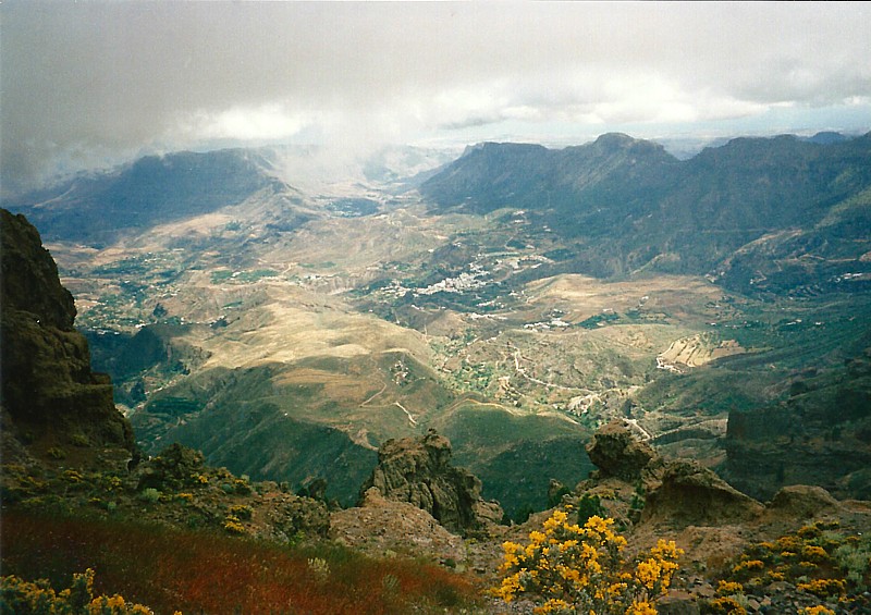
mountain. The last 10 km are not so hard and finally we reach the highest
point of Gran Canaria. Here we have a marvellous view on the island.
Soon after that we start to descend. The last 20 km we descend in the
dark, which is very dangerous because we have no lights on our bikes. We
arrive safely at the apartment.
Wednesday, Thursday 7,8 May 1997
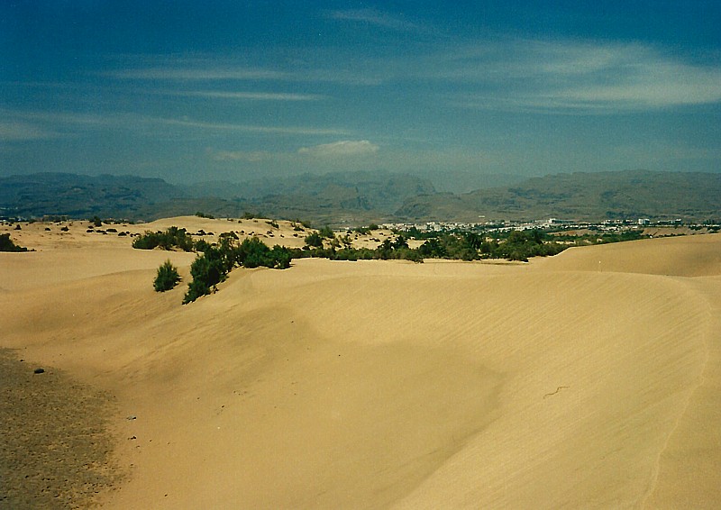
The forth and fifth day we have some rest days. We visit the beach
and take a walk through the dunes of Maspalomas. The next day we rent a
car and make a round trip along the island.
Friday 9 May 1997
The next day I start in Puerto de Mogan. Martin has brought me here
by car and he is going back to pickup Johan and their bicycles. The climb
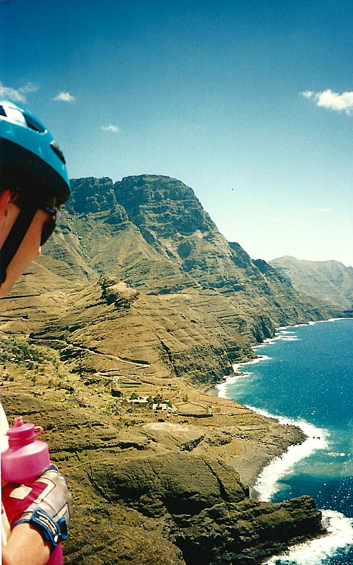
between Mogan and San Nicolas is not very hard, but the scenery is changing
every minute. With every bend you have got another view on the rough coast.
After reaching the top at 996 meter I descend to San Nicolas.
Here I have to wait for one hour until Martin and Johan arrive. Together
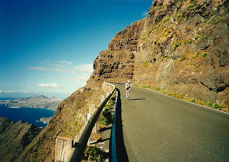
we start with the marvellous coastal road between San Nicolas and Agaete.
This part is fantastic, with amazing views, very steep cliffs, narrow roads
and a beautiful scenery. In Agaete we stop for a break and we return along
the same way to San Nicolas. Martin is going to ride to Mogan and Johan
brings me back with the car to Playa del Ingles.
Saturday 10 May 1997
Johan is dropped by car in San Bartolome, where he starts to cycle.
Martin picks me up and together with two bicycles in the back of the car
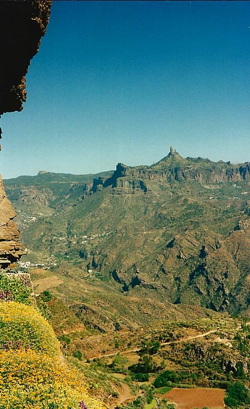
we drive to Parador Nacional de Tejeda. During this ride we enjoy the impressive
landscapes in the centre of the island (Ayacata, Tejeda, Parador) with
a view on the amazing rocks Roque Nublo en Roque Bentaiga. Johan has already
arrived at the Parador and we prepare ourselves for a round trip in the
northern part of Gran Canaria. In this part there are more roads, villages,
vegetation and it is more populated than the southern part of Gran Canaria.
We start to descend through a lot of villages (Lanzarote, Balcon de Zamora,
Firgas and Arucas). Here we have a lunch at the stairs of the cathedral
of Arucas. After that we start to climb back to Teror, Vega de San Mateo.
Here Johan cycles to the rented car and we climb along the steep road to
Cueva Grande. After the top just a couple of kilometres from the highest
point of Gran Canaria we start to descend to Ayacata, San Bartolome and
Fataga, back to Playa del Ingles.

Sunday 11 May 1997
Johan and Martin want to have a rest day, so today I make my own trip.
I start along the busy GC 12. In Aguimes I ride
through the barranco de Guayadeque. It is a very narrow canyon and
it is a dead end road. The temperature is very hot and that makes cycling
very hard. With a slow cadence and a speed nearby the 8 km/hour the climb
takes a lot of time. It is very crowdy, a lot of Canarian people are having
a lunch under the trees. Finally I reach the end of the road and within
a quarter of a hour I am back at Aguimes.
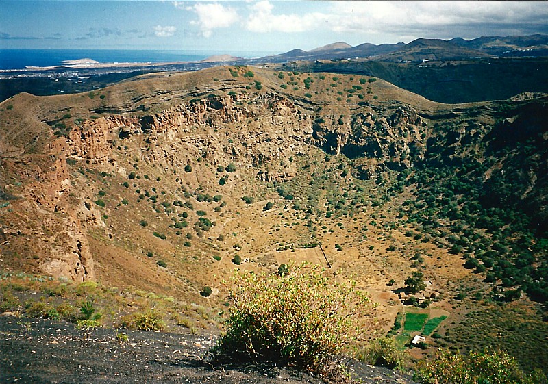
I visit some old cave ruins, Cuevas de Pilares and cycle to the top
of Pico de Bandama, an impressive crater.
On the way back I have some difficulties to avoid the highway nearby
the airport, but I succeed to find a dirt road along the high way.
Monday 12 May 1997
We start very early and we ride along the busy GC812 to Telde. There
we start with the east side of the climb to Pico de las Nieves. This climb
is a real killer, a height difference of 1900 meters in 28 km. Especially
the kilometres from Cazadores until the forest are very hard. The weather
is making it worse because of the pouring rain. I have problems to get
the right cadence and there is not much of a view. I am glad at the moment
I have reached the top and quickly we start to descend to get some warm
feet.
Tuesday 13 May 1997
Today we make a small round trip. We start again along the G812, where
we have to cope with a strong headwind. We pass El Doctoral, Sardina, Aguimes,
Temisas, Santa Lucia and return via San Bartolome and Fataga to the apartment.
Thursday 14 May 1997
On the last day I purchase a camcorder. With this new toy I make some
nice shots during the climb to Fataga, our standard climb which we have
done a couple of times. I have mounted the camcorder in a saddlebag, so
we have some cool video snaps just like in the cycling races.